Thursday, November 19, 2009

[Pause button pressed]

As I'm in the thick of applying to grad school, I'll not be posting new entries about hiking, unless I take a day hike here, an overnighter there. Check back in February or March, when I'm due to start preparing for the second half of the AT, from Springer Mountain, Georgia, to Harper's Ferry, West Virginia. Then this blog will fire up again in style.

However, as new photos from this summer continue to trickle in from other hikers on the trail, I'll be posting them and linking them with their appropriate entries from earlier in the blog. The first example is below.

It was a blessing hiking with you and reporting back to the rest of you. Here's to the next big walk,

-Jeremy 'Ink' H


[first touch of the sign, Sept. 21, 2009]

Saturday, October 17, 2009

Update: Winter crash lands on Fall

...and I've crash-landed back into the civilized world.

First, though, I trickled south by bus and train from Maine to Maryland. Along the way I got to see some big East Coast cities. Even before that, I tried the "Summit Sundae Challenge" at Millinocket's Appalachian Trail Cafe.

Fourteen scoops of ice cream, a giant-sized Snickers bar, an enormous homemade doughnut and a pack of M&Ms. The challenge? Eat it all in under 90 minutes. The prize? an awesome T-shirt. With the ice cream, Snickers and doughnut gone, I was staring down the barrel at goop and M&Ms, with like 45 minutes to go on my 90-minute time limit. I couldn't do it. Every time I ate another cold M&M I felt one more M&M away from losing all my shit on the table.

So that was the first thing I ate after getting down from the summit of Mount Katahdin. The rest of my time in Millinocket I spent with Early Bear and another hiker hanging out at the Appalachian Trail Lodge [my final hostel on the north half of the trail] and bowling and picking out songs on jukeboxes.

Then it was time to leave Maine. Stop 1: Boston. When? During rush hour. It worked out. We got a hotel next to Fenway Park.

After lunch in the Green Monster [yes, there's a restaurant in the wall at Fenway Park], we three hikers hiked around the stadium and wandered onto the set of the movie "The Town," which is directed by Ben Affleck and scheduled for release in September 2010. It took me a second to realize what was going on - police cars and an ambulance with bullet holes, young dudes walking around with tool belts. Obviously the movie's going to be some kind of crime drama. Like "The Departed," it promises to be heavy on the Boston.


[On the set, road outside outside Fenway Park, Boston]


[Crew members ready for the next shot on the set of "The Town," Sept. 24, 2009]

Stop 2: New York, where I saw batman manhandling tourists:


Back in a bit.

Tuesday, September 22, 2009

Seize the day

Climbing Mount Katahdin on a Class I day [excellent weather, all trails open], Monday, Sept. 21, 2009...


[Starting off, 8 a.m., with 5.2 miles to the peak, Sept. 21, 2009]


[Lil' Dipper and Holmes, ascending Katahdin]


[Early Bear ascending]


[The ridge]


[Another busy day at the top]


[When I got to the top, some of the day hikers urged me on. I kissed the sign when I got to it [there's a foto of this, I hope to have it this week]] and then I settled down for this relaxed shot. The sunglasses were a hiker box find, if you were wondering :)]


[Part of Early Bear's photo shoot]


[Lil Dipper's turn on the sign]


[swordmaster Ink]

More on all this later. But, yes, my WV>ME '09 hike is finished. Love ya!

Sept. 20: Last night, last supper, last shelter

It was 10 miles or so from Rainbow Stream Campsite to Linda's Store at Abol Bridge. I sat down at a picnic table along with Holmes and Watson, a hiker named Nina, Tord M. Johnson [Tord is the creator of Rock and Crawl, an AT cartoon strip everybody's been enjoying in the trail registers along the entire trail] and a parks official/AT ridgerunner.

After six days in the woods, a couple of burgers, even microwaved ones, as it were, and a couple of Long Trail Ales hits the spot.

Entering your last night on the northbound AT feels like being ushered in to the launch facility for a space shuttle flight. You have to start hiking the 10 mile trail to The Birches, the final shelter, before 5 p.m. because you have to register there [and pay $10 cash only] before 9 p.m.

The ridgerunner escorted me and Holmes to a point where we had to sign in before entering Baxter State Park. Watson had to go to a dog sitter in Millinocket because no pets are allowed in the park. The ridgerunner handed me a pair of binoculars to study the top of Katahdin. He pointed out the approach: Up the horn on the left, past Thoreau Spring, across the middle section that juts out and finally to the tiny speck that is the pile of rocks 30 feet from the sign.

Through the binoculars, I could see a very tiny cluster of moving specks. The top was busy, it being a weekend and a sunny day. The Knife's Edge trailed off the peak to the right.

I already knew from trail registers that I would be summiting along with Early Bear and Lil Dipper. From the register at the edge of Baxter I learned that Wis-pee would be up there, too, and Holmes had increased her pace to arrive at The Birches on the 20th.

Great crew to summit with, if you ask me. After all, my first night on the AT I spent in a shelter in Maryland with none other than Early Bear. Full circle! And entirely by coincidence.

At The Birches, it was just us, along with an older hiker named Chris and Wis-pee's girlfriend, with the beers we'd packed out from the store, a good fire and the final night of noodles or chili or whatever in our pots. It truly felt like any other night on the trail. But it wasn't: We had entered the final stage of the final leg of the home stretch. Our names were in the books, our dates with Katahdin were booked. The next day, Monday, we would finish our hikes on the AT...

To the end

Over the days following my big 24 Katahdin crept closer and closer into view. I had caught up with Holmes and Watson; Early Bear Lil Dipper and Wis-pee were still ahead.


[Me crushing Katahdin from the safe trail distance of 36.4 miles, atop Nesuntabunt Mountain, Sept. 19, 2009.]

I cowboy-camped on Sept. 19 on a pre-made bed of leaves at Rainbow Stream Campsite. With the moon in its new moon phase, the night sky glittered with stars. The fire crackled, and I could hear loons crying over Rainbow Lake which hit the shore about 100 yards away. It was time to contemplate being in the wild for more than three months.

It was also time to contemplate getting out of the woods. Baxter Peak on Mount Katahdin lay just 26.4 miles away, and there would be just one more night of camping.

There is no more beautiful state on the trail than Maine, and I hiked it during a fortunate spell of weather. Since I entered Maine on Aug. 26, I'd had only a couple hours of drizzle aside from the Tropical Storm Danny day. Every other day, the sky was blue and the birches stood out white along a dry trail.

I got the fire going again next morning at 6 a.m. in preparation for a 20 mile day. These days, I was starting off the morning with the equivalent of four cups of coffee in the form of Folgers singles [you steep them like tea bags].My pack weighed less and less each day, so it became easier to fly along the trail.

I got a couple more shots of Katahdin on the way to The Birches, the final campground on the AT northbound.


[Katahdin from 21 trail miles away on Rainbow Ledges, Sept. 20]

At Abol Bridge, the boundary between the 100-Mile Wilderness and Baxter State Park, the mountain really dominates the view.


[Mt. Katahdin from Abol Bridge, 14.5 trail miles away, Sept. 20].

Day 100/Sept. 18: Getting the miles going again

I got up at 6:30 a.m. in the East Branch Lean-To by myself [an older SoBo was tenting nearby], got the fire going again and hit the trail at 7:40 a.m. for a big day. And a big day it was: For the first time since July 20 [Day 41] I hiked more than 21 miles in one day.

I did a fast-paced, 24-mile day over the easiest, flattest section of trail since at least Vermont and arrived at Nahmakanta Stream Campsite at dinner time to catch up with Holmes and Watson at the fire.

Watson, the dog, stared at me while I cooked up some chicken and rice wraps. It was too messy so I ate them out of my bowl.

Along the way to the trail I fell into a bog, after slipping on a bog log. I put all my weight on my left foot on the edge of a wet og log, and my foot slipped, stripping the bark off the underside of the log. My foot went in past my sock. My right knee hit the boards, and my right hand, wrapped around the handle of my trekking pole, punched in up to the forearm.

Bog log got me good.

[Photo later - used backup snap-n-shoot and have to develop the film yet.]

Also, when I tried to dry my socks out, the fire got too close and singed the bottom of one into black. Another pair down!

Day 99/Sept. 17: First Katahdin sighting

A flash of black fur left the trail ahead of me and flitted into the dense woods as I hiked down the north slope of White Cap Mountain [elev. 3,650], where I had finally seen Mount Katahdin from a distance.


[Mount Katahdin, 70 trail miles away, from White Cap Mountain. White Cap was the highest point until Katahdin at that point. Between my hand and the summit, the woods teemed with hikers.]

I stopped hiking at about 4:30 p.m. because I had been dreaming of cooking up a big meal of mac & cheese with pepperoni all day. It felt great to be done in the daytime for once!

Sept. 15-16: Waking up in the Wilderness

I started the morning at Wilson Valley Lean-To by doing a food inventory after breakfast [Cheerios and coffee] and hiking out late, at 11. Before dawn, though, I did wake up and look over at the shelter to see three French-speaking hikers getting a big fire going.

A sample of the food inventory in my 60-pound pack:

Drinks:

- 10 Carnation instant breakfasts
- 1 baggie of powdered milk
- 23 Folgers singles packets
- 7 Gatorade packets
- 9 Crystal Light packets
- 13 tea bags

It turned out that I had dinners for 8 days - 2 too many - and a pound and a half of cheese. Yum!

The day's hike took me over Barren Mountain [elev. 2,660] which gave me a workout with my very heavy pack, and I ended up looking for a place to set up my tent after dark, tramping along the trail with my headlamp on.

I found a place near three other tents next to West Chairback Pond, off a side trail. There was no moon, so the stars and planets reflected brightly off the pond's surface when I pulled some water out of it to cook with.

In the morning I got up, stood up outside and saw gray skies and my breath frosting in the air and got back in my sleeping back. Did some journaling, made a fire next to the pond and started hiking after 1 p.m. [!]

Which meant it was inevitable that, 6 hours and 11.6 miles later I'd be looking for a flat spot for my tent with my headlamp again, near the Carl Newhall Lean-To.

Day 96/Sept. 14: Entering the Wilderness

On morning number 3 in sunny Monson, we had a hikers' breakfast at Shaws' Lodging. I only got the No. 2 because I didn't feel like being rolled down the trail to start off the 100-Mile Wilderness.

After breakfast Early Bear, Lil' Dipper, Holmes and I went back to the Lakeshore House and packed up. Slowly, though, since L.A. Confidential was on. Then we all weighed our packs in preparation for a week without resupply. My pack weighed in a 60 pounds.

"Welcome to the 60 Club!" said a hiker named Morningwood, high-fiving me.

We shuttled out to the trailhead at noon or 1 p.m.

Towards evening we encountered Big Wilson Stream. It required fording. The boots and socks came off, and the awkwardness of walking through cold, flowing water with slimy rocks for footholds commenced. When I had finished, I trained my camera on the next hiker to ford the stream, as Early Bear had done before me.


[Wis-pee finishes fording Big Wilson Stream with a flourish, Sept. 14, 2009.]

Then it was .7 miles to the Wilson Valley Lean-To for Holmes and Watson, Wis-pee and I while Early Bear and Lil' Dipper kept hiking. I finished the night with a delish pot of double-Ramen + horseradish cheese + tuna by the fire and tented.

During the night I hear a lot of scampering in the bushes nearby. It sounded like squirrels were doing gymnastics. One bounced off my tent, scaring the crap out of me.

Update for September 22, 2009

I'm in Millinocket, ME. Just finished breakfast at the Appalachian Trail Cafe. Zeroing today. Read above for the past week's AT hike later today.

:)

Monday, September 14, 2009

Crossing the Kennebec

I crossed the Kennebec River Sept. 9. Kennebec is an Abenaki tribe word meaning "long level water without rapids."

The river is the biggest unbridged river on the AT. In the 1980s a woman attempting to ford the river drowned, and shortly thereafter a free ferry service took hikers from one shore to the next.

The canoe even has a white blaze on it. When I went across, at about 2:30 p.m., the river was flowing high. The rower steered up along the south bank and then shot into the middle, with me paddling in front, and angled the boat so that it was pointing upstream and we were drifting down and to the right towards the landing.

As it happens, had I arrived about a week earlier I might have been in a news story in the Bangor Daily News about the ferryman, who told me to call him "Hillbilly Dave."

Here's the story. In the pictures you'll see why "Hillybilly."

BTW, the hikers rowing in one of the photos are Slapshot and Raddlephoot.

100-Mile Wilderness is next

Been slacking around Monson since Friday evening. Today was the famous all you can eat breakfast at Shaws', where you order by number - a 2 means two pieces of French toast, two eggs, two pieces of bacon, two pieces of sausage and some home fries.

At the moment everyone's packing up their resupplies and mail drops and calculating how much food they'll actually need for the rest of the trail. Unneeded stuff goes in the hiker box.

Saturday and Sunday morning, the folks from Whiteblaze.net hosted a hiker feed behind the abandoned elementary school here in Monson.


[Dave [last name?] the operator of Whiteblaze.net, helps with the flapjacks, Sept. 13, 2009.]

Had a chill Sunday after that. Ran into a nearby town, Greenville, via a shuttle from Shaws' with Zipper and two SoBos, for a huge [$85!] resupply. One final hurrah at the Lakeshore House, on the edge of Lake Hebron:


[Pub at the Lakeshore House, a laundromat/bar/hostel on the waterfront in Monson. From left, Wis-pee, Early Bear, Lil Dipper, Zipper, Nutmeg, Billhoot and Ink]

Saturday, September 12, 2009

Biig photo dump, from Rangeley to Monson, Maine


[Some stairs. In Maine. Yeah.]


[Bears. Outside the Stratton Motel, Sept. 6, 2009]


[East Carry Pond, Sept. 9. Is where I swam and realized I have little arm strength.]


[Alpine moss]


[Summit of Moxie Bald Mountain, elev. 2,629. The Laurentide Ice Sheet shaped the rocks when it was melting more than 14,000 years ago.]


[Folk jam session, Monson General Store, Sept. 11.]

Update for Sept. 12: Monson!

I'm zeroing in Monson. I'm headed shortly to the baseball field up the street for the trail's end hiker feed sponsored by Whiteblaze.net.

One hundred and seventeen miles to go. My projected summit date is Sept. 20.

After I leave this kickass town, the last trail town on the AT, I will be entering the 100-Mile Wilderness.

100-Mile Wilderness, says my book: "Signs at each end of this section proclaim this area's remoteness and warn the unprepared hiker to stay away, but don't be intimidated."

Nevertheless, I'll be packing two full canisters of fuel and a bunch of food.

BTW, a hearty trail "Thanks!" to LP and Sis for much-appreciated packages! I just picked them up at Shaw's Lodging today. I've already sampled the candy.

Cheers,

Ink

Thursday, September 10, 2009

3 Months!

I'm at Northern Outdoors in Caratunk, ME, with 150 miles of trail to go before the top of Mount Katahdin.

It's a brewery slash lodge in the middle of nowhere. Moose head on the wall and T-shirts for sale. Snowmobile parked outside. No USB ports again [seriously?], so the photos will have to enter the blog later this week.

It looks like I won't be participating in the trails end hardcore work project that I mentioned earlier. It's just too far to Monson for me to hitch, and damn if I didn't get a bunch of answering machines when I tried to inquire about a shuttle. I really wanted the chance to give back to the trail and be able to say, "You know the X shelter in Maine? I helped build that."

But I'm consoled by an easier goal of going to the hiker feed in Monson on Saturday and Sunday that I've been seeing flyers about.

I started this hike exactly three months ago today. I've hiked more than 1,000 miles of the AT at this point, which feels pretty good :)

So here's an image from trail's past, which I just received by email...


[From left, Sunbeam, Huck Finn, Half Moon and Ink represent OHIO, somewhere around Delaware Water Gap, Pa. Sunbeam and Half Moon are fellow MU Ohio grads; Huck Finn and Half Moon realized they went to the same high school.]

Sunday, September 6, 2009

PRW News Ticker: Sunday, Sept. 6

- I'm in Stratton, ME, with 200 miles to go to the big K. Stealthed last night at the road. Picked up my Patagonia thermal layer and some cookies and magazines this morning after breakfast at the Stratton Diner. Wis-pee, Blacklist and three other hikers I don't know have hiked out. I'm thinking about doing laundry and shower then hiking out 15 miles.

- Jimmy Buffett song "Cheeseburger in Paradise" in my head all day yesterday. "I like mine with lettuce and tamatah; Heinze 57 and French-fried potatahs!" Will soon eat what he sings about. At the diner.

- Had coffee break on a boulder in a branch of the Carrabassett River yesterday evening, just before hiking over the south and north peaks of Crocker Mountain.

- Chance has summitted Katahdin. Which means a few other people I've met prolly have, too.

- Heard rumour of a trail festival thingy coming up Sept. 11-13, where you work your ass off on the trail the 11th and jam band the rest of the time. Will look into it further because that sounds pretty fab.

- Hoping for a post-summit rendezvous at Bar Harbor. Will see if that gathers steam. That way it'll be my birthday somewhere fun.

- This computer sucks because I can't upload photos.

- My writing is coming to resemble trail register entries.

- Maine on the braine. Caratunk in 3 days.

- Football season: Go Bungles!

Thursday, September 3, 2009

Update for Thursday, Sept. 3: Trail magic score

So last night I spent the night in a hotel. I got a couple of showers, some A/C, a bed and some bad TV.

It was trail magic. Big trail magic. And it was good.

When I made it to the road leading to Rangeley at 6:40 p.m., out of water, knees and feet throbbing and ready for some nourishment, I spotted Wis-pee having a Gatorade and talking to a couple next to a Suburban. I had hiked 17.7 miles; the last time I'd hiked more than 15 miles in one day was before Hannover [Aug. 6].

The couple were Steady, a '93 thru-hiker who went on to triple crown [also hiked the Continental Divide Trail and the Pacific Crest Trail], and her husband, Steve. They are from Tulsa, and are vacationing around the country. They'd been in Rangeley for two weeks and have been giving drinks and rides to hikers coming through.

So they took Wis-pee and I to dinner in town. I don't remember being so full, after eating salad and a ton of pizza. They also took us to IGA to resupply, which was wonderful because the store is a mile out of town, and there hasn't been anywhere to get long-term supplies since Lincoln, NH.

While we were shopping, Steve came up and handed us keys: He got us a room at the same hotel they were staying at. It was one of the kindest gestures, the kind that, as Wis-pee said, you hear about happening to other hikers but never to yourself. We couldn't believe our fortune!

It topped a pretty fantastic day on the trail.

I got out of camp at 11 a.m. yesterday at Bemis Mtn. lean-to. What can I say? I slept in, had tea and did some journaling. It was a perfect morning to wake up in the woods.

I realized that if I gunned hard for Rangeley, I would have probably the greatest chance I'll get to get back to the kind of hiking I was used to before the Whites make me work for every mile. The terrain was said to be nice and flat.

Along the way I saw a garter snake that wanted to play. It left the trail, then came back towards me, in a nonthreatening way. Katchup and Grommet had seen it, too.


[inquisitive garter snake on the trail, Sept. 2, 2009.]

Photo dump: Hitchin'

I'm trying to take more pictures of the hitchhiking experience. Ever since Vermont, when they started putting trail towns 8 miles out of the way for some reason, hitchhiking has become an increasingly important aspect of hiking the Appalachian Trail.


[Dogs joined me in the back of truck headed out to East B Hill Road, with another hiker in the front seat, Aug. 30]


[Hitching back to South Arm Road from Andover after breakfast, Sept. 1. From left, Billyhoot, Wis-pee, Blacklist and Grommet]

Campfire!

A day after I hiked out of Andover, where I stayed at the Pine Ellis Lodge, I was back in town. It was at noon on Aug. 31 when I hiked down from Moody Mountain to South Arm Road, a country back road, and found Nutmeg and Billyhoot camped out at a stealth site near a big creek and told them I was going to hitch into town for lunch and hitch back out.

Katchup and Grommet joined me and we got a ride from a man and his wife; he moved some flyfishing rods out of his truck bed before we got in. The plan was to get pizzas and beers and bring it all back.

I love it when a Monday goes askew, and suddenly the worst day of the week is totally unfamiliar, in a good way.

We ended up calling David, the manager of the Pine Ellis Lodge, for a shuttle back out because hitching just wasn't happening. In fact I finished my pizza, and a pint of ice cream, on the side of the road at the Andover General Store.


[Andover General Store and diner]

We got back and crossed the stream.


[Grommet and Katchup go into the wild with pizza, Aug. 31, 2009.]

Later on, Wis-pee and Blacklist showed up, and David from Pine Ellis took a break from work to come hang out with us. He busted a couple of jams on his flute and dropped a case of trail magic Budweiser.


[Wis-pee, David, Nutmeg, Billyhoot and Grommet, with the campfire.]

At some point, the idea of breakfast at the diner came up. It turned out that David had an appointment to drop a hiker off at the road at 8 a.m. the next morning. Our luck, he was willing to take us all into town if we showed up.

There was never any doubt about us showing up for breakfast.


[Andover diner, Sept. 1.]

We took over half the counter and the food was delish. I had a bacon cheese omelet with home fries and toast and a sundae for dessert.

PRW news ticker, Thursday, Sept. 3

- I'm in Rangeley, ME, 220 miles from Mount Katahdin. Projected summit date is Sept. 17. It hasn't sunk it yet that I'm in Maine, and that I got here from West Virginia by walking.

- Hikers I've met on my hike are beginning to summit. Pusher, Fly By, Snarl, Apach, Porkchop and Hardcore were the first.

- Mississippi is in Mississippi, uploading sweet photos from the trail.

- Hiking in the Middle East? Know your borders, I guess. Three American hikers have seen their Iraq hike [can some news person do a story about how that came about?] turn into an espionage case in Iran.

Looking back at New Hampshire

My contribution to the AMC [Appalachian Mountain Club]:

- $34
- 3 and 1/2 hrs of work

In return, I got seven nights of shelter and six awesome meals. I was in the White Mountains from Aug. 13, when I climbed over Moosilauke, until Aug. 26, when I crossed NH Rte. 2, the northernmost road leading to Gorham. For the days I hiked in the Whites, my average daily distance was just more than eight miles.

No pain, no Maine

Here's a series of photos from last week that correlates with posts I wrote in Andover.


[Heading towards Full Goose shelter, the second shelter in Maine, in the evening. Aug. 27, 2009]


[The beginning of the Mahoosuc Notch, Aug. 28.]


[Getting into the Mahoosuc Notch takes some dexterity. I had to de-pack twice to squeeze through.]


[Baldpate Mountain on Aug. 28, the day before I climbed it.]

New trail terms

To stealth camp: To camp somewhere not specifically designated for camping, like this.

SoBo/NoBo: Southbounder, northbounder.

Sunday, August 30, 2009

Poem of the week

Savor this Robert Burns song until I update again later this week. I heard it in song form on NPR's "Thistle and Shamrock" show, and it quickened my steps on the trail.

"Lines Written On a Tumbler"

You're welcome, Willie Stewart;
There's ne'er a flower that blooms in
May,
That's half sae welcome's thou art.

Come, bumpers high, express your joy,
The bowl we maun renew it;
The tappit-hen, gae bring her ben,
To welcome, Willie Stewart.

May foes be strang, and friends be
slack,
Ilk action may he rue it;
May woman on him turn her back,
That wrangs thee, Willie Stewart!

Aug. 26-29

- Aug. 26: Imp shelter to Trident Col campsite, 14.9 trail miles

I read in the registers that I was catching up to people I've been hiked with previously. The hike from Imp shelter to US Rte. 2 rolled me out of the White Mountains. At the road I could have hitched back into Gorham easily, but I opted not to. At night it felt amazing to be in my tent again. The temp dropped to the 40s; It was maybe the first time I zipped up my 20-degree down bag all the way.

- Aug. 27: Trident Col to Full Goose shelter, 14.4 trail miles

I crossed the Maine border in the afternoon and caught up Prairie Dog and Angry Beaver and Gritty McDuff, and a host of other hikers I couldn't recognize in the shelter, or in the several tents set up around it - it was 7:30 p.m. and cold, everybody was laying low in their sleeping bags and boggons.

I cooked noodles and spent a chilly night in my tent.

- Aug. 28: Full Goose to Baldpate lean-to, 12 trail miles

The day started out with the hardest mile on the entire AT: Mahoosuc Notch. My trail book says thus: "Many call this scramble under, around, over, and between the boulders the most difficult mile on the Trail."

Ha. I played Mario - every time you lose your balance and fall, you lose a life. I lost 4 lives. I had a great time navigating the boulders.

Afterwards I ate my last lunch food: Tortillas with Nutella, peanut butter and jelly - pure energy :)

At the Baldpate lean-to a brave mouse flitted around the front of the shelter. He would return in the night...

Aug. 25 and 26: Zero day and reentry to the trail

- Aug. 25: Gorham to Gorham, 0 trail miles

I zeroed in Gorham but foolishly did not go to the Super Wal-Mart to resupply, which I would regret later.

On the good side, my loaner pack arrived in the afternoon. I mailed my broken-down pack [it broke near Lincoln, NH, which I note here] to California with a deliberately-worded letter of complaint tucked inside. Gregory, the company that made it, has told me they will repair the pack damage. I doubt it. The mainstay came completely undone from the bottom of the pack.

The weather alternated between brilliant sunshine and quick downpours all day long.

- Aug. 26: Gorham to Imp Shelter, 13.1 trail miles

I hitched a ride back to the Pinkham Notch visitors center to resume my hike. The center had already stopped serving breakfast so I had an early morning burger. My new earbuds, cheapies from Rite Aid, fell out of my ears repeatedly as I began walking. The third time they got wrapped around one of my trekking poles, and in a fit, I threw the pole down the trail. The earbuds were no more.

The hike took me 1,940 feet straight up Wildcat Mountain immediately. At the top I wrung my shirt out and got some sun while talking to an older hiker who was in the process of making up the miles he'd skipped on a 2002 thru hike.

I checked in at the last of the AMC mountain huts, Carter Notch hut, to drink a bunch of water, read the register and eat some snacks. On my way out I passed Brave Little Toaster and his dog, Pork, and Frank N. Stein.

The trail went up a grueling 1,480 feet and settled into a ridge walk with clear views of the Whites on all sides; the sun fell directly behind Mt. Washington. I was very tempted to stealth camp on Mt. Hight. But I was behind most people I knew, so I hiked.

I was hiking in the dark with my headlamp when Frank N. Stein caught up. The 1,000 feet slab ride down from North Carter Mountain had been fearsome - wet slabs, vertical drops, swinging from young pines and tree roots in the dark - I could only imagine how difficult it must be for Toaster and the dog.

At Imp, the shelter was the only place we could stay; the tent platforms were full. The shelter was crowded and dark. It was 9:15 p.m. I cooked up a double Ramen dinner outside the shelter. I crashed hard.

Aug. 24: Wrong turn to Gorham

- Aug. 24: Madison Spring hut to Gorham, NH, *7.8 trail miles

After the fog rock hike down Mt. Madison, which comprised about 10 hikers, three of us got lost at a trail junction. The trail-maintaining club for the Whites, the AMC, is notoriously bad at marking the AT, and nowhere have they done a poorer job than at the Osgood campsite. The wooden signs there reveal nothing; no white blazes are in evidence on any of the hundreds of trees on which a white blaze could be painted with a couple of brushstrokes.

Three of us forged straight ahead when we should have taken a 90-degree right turn. The trail turned out to be a leisurely ski slope to the highway, and from there, we road walked 1.5 miles to a visitors center, where we ate lunch. Then the three of us - Spaceman Cowboy, Gritty McDuff and myself - stood on the highway shoulder, thumbs out, focusing our attention on trucks.

I've hitched into towns half a dozen times now, and I've never gotten a ride in anything but a truck driven by a dude. And 30 minutes of hitching later, we were in the back of a pickup truck, headed into Gorham.

We got out at a hostel called The Barn, a open-air hostel attached to a B & B that flies both the US and Canadian flags. A woman with an Eastern European accent came out and had us register and pay immediately. I asked if she had Internet.

"Yes, but you can't use it," she said. Not sure what effect she was going for, but my reaction was to laugh.

That also kind of set the tone for Gorham as a trail town. But at least I got to shower away a week's worth of mountain and to sleep on a bed instead of a table. That was sooo refreshing.

For an unknowable number of hours, a group of us hikers sat mesmerized by MTV's "Nitro Circus," a Jackass-type of show [Johnny Knoxville produces it and makes cameos] involving professional Xtreme athletes and absurd stunts.


*not actually that many miles. More than half of that I blue-blazed or road walked or outright didn't do.

Recap, Aug. 24-30 [Gorham, NH to Andover, ME]

There aren't enough USB ports on this comp for me to use the Internets, the mouse and upload photos, so I'm going to put just the words down for now and do a photo dump later this week, in Rangeley or Stratton. Please read above and bear with!

Saturday, August 29, 2009

What's ahead on the AT

For starters, 256.6 miles of trail. Some bogs. Some logs that, when you step on them, make you slide into the bogs. Two must-stay hostels: Shaws' Lodging in Monson [114.6 miles from Katahdin] and White House Landing [47.5 miles from K]. The "100-mile Wilderness."

And Katahdin, otherwise known as The End. Katahdin is a mountain 5,268 feet high in the middle of nowhere. A climb of more than 5,000 [no, scratch that; it's 4,000] feet 5.3 miles from the nearest shelter is necessary to summit it.

At an average of 10 miles of hiking per day, the end is 25 days away [Sept. 22 - my birthday]. I supposed when I started this hike, on June 10, that I would summit on or about Sept. 10. But I actually began my hike 100 miles behind the halfway point, which would make Sept. 17 the logical summit date for me. And if I average 15 miles a day, I will be summiting on Sept. 14. So sometime between Sept. 10 and 22 I'll be up on that mountain posing for the camera.

After that remains the question of getting home. Hitching 17 miles to Millinocket has to be done. Then it's a bus to Portland or Bangor, and hopefully a train down the coast. If no train, then a bus to Boston and I'm riding the Acela to good old, comfy Washington, D.C.

Maine ain't no joke, brah

I'm finally in Maine!

It's the 10th state I've hiked through on this journey. The other four - Georgia, North Carolina, Tennessee and Virginia - wait for me in the future.

The past several days of hiking have turned my legs into beaten sticks. It's like every day is another Lemon Squeezer day. It's not just me: This hostel, the Pine Ellis hikers hostel in Andover, ME, is full of hikers washed out of the mountains by today's rain.

In fact, today's 8-mile hike taught me to respect the whims of a powerful Mother Nature.

I had the unpleasant sensation last night of waking up to a mouse scurrying all over my sleeping bag. When I shook it off and looked up, I could see, and feel, a windy rain blowing all around the Baldpate lean-to. It was 1 a.m. When I got up at 6-something it was still raining.

I whiled away the early morning reading the book I just picked up, Jack London's "The Sea Wolf," and the three other hikers in the shelter, whom I'd only met the night before, did much the same. They were content to wait out the rain. That wasn't an option for me, because I had no food other than peanut butter. So I hiked out at 9:40 a.m. in my pants and rain jacket and soon summited Baldpate Mountain, elevation 3,810 ft., in a hard, chilly wind whipped up by Hurricane Bill [actually, it was Tropical Storm Danny].

No trees grow on the summit of the aptly-named Baldpate: It's all rock and alpine plants. I'd look up every few steps and peel back the hood of my rain jacket to see where the next cairn was, then put my head down and work my shoes into the rock in an effort to head in the cairn's direction.

It was the first time of my trip that I actually worried about getting stranded. So I did what any movie fan would do: I challenged the mountain to a duel, Gandalf-style: "You can't beat me!" I shouted at the wind.

So that was my day. Oh, and when I hitched a ride into Andover four miles later, the driver gave me a Budweiser "Clamato" a can of Bud flavored with clam juice, tomato, lime and salt.

Only in Maine!

Monday, August 24, 2009

Fog rock hike day


[Early Bear hiking down Mt. Madison. Ahead of him are Gritty and Wispee, morning of Aug. 23. Very treacherous trail, but cool thing to do.]

Aug. 22 continued: The migrant worker experience

I reached Madison Spring hut at about 4:30 p.m. Normally it's best to arrive between 5:30 and 6 p.m. to ask for work-for-stay, but a hiker named Gritty McDuff and two European hikers, a couple, named Rock Lobster and Walkabout, were already slaving away in the kitchen.

Early Bear and Lil' Dipper sat at a table. When Gritty was finished working, we got a game of Jenga going, which was a freaking blast.

Hikers kept rolling in. We had to wait outside like migrant workers while the paying guests had dinner. We had a lot of laughs, though. It was raining so we smooshed into the vestibule.


[Gritty McDuff, Early Bear, Spaceman Cowboy, Rock Lobster, Lil'Dipper and Wispee, on the threshold of Madison Spring hut, Aug. 22.]

Aug. 22: The Presidential Range

As soon as I reached the top of the Tuckerman Ravine trail, which goes straight up - straight up - Mt. Washington from Hermit Lake shelter, a group of upstate New Yorkers wearing farm clothes and bonnets asked me where I was hiking from.

"West Virginia," was my response :)

It's getting very common for me to find myself explaining hiking the Appalachian Trail to tourists.

From there, it was a short day of hiking, 5.7 trail miles, to Madison Spring hut, over the Presidential Range of the White Mountains, where I saw the most spectacular views I've seen during my entire hike. It's 25 miles of above-treeline, alpine hiking. You can see exactly where you're going to go and you know how far that is. It's as though you have been dropped into a role-playing video game, somehow. Time actually flies while hiking, for once.


[The Presidential Range, Aug. 22, 2009]


[Looking back up to Mt. Washington, with summit building on top, across the Cog Railway. The railway is a short old-timey passenger train for tourists. It was once an AT tradition to moon it as it went by, but there was a crackdown in 2007 and nobody does it any more.]


[Approaching the mountains. The AT actually skirts all the peaks, but the views are still breathtaking.]

Aug. 21: Stranded on Washington

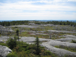
Man, it was foggy on the way to Mt. Washington. A weather bulletin interrupted the NPR program I was listening to to talk about a severe T-storm heading NE through Vermont at the moment.


[Hiking to Mt. Washington, elev. 6,288 ft., Aug. 21, 2009]

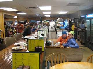
When I reached the summit, big objects began materializing out of the wall of white. A radio tower here, an ancient stone building there; I found my way into the crowded summit building. While I was walking around, Early Bear and Lil Dipper walked in through the front door. They'd gotten a mile down the trail when they realized they'd left Dip's camera battery charger plugged into the wall.

I had some food, two slices of pizza, a chili dog and an ice cream sandwich. It started raining:


[Wet entrance to the summit building]

The fog clung to the windows. On the computer screens they have set up showing the weather radar, a big patch of green, yellow and red rushed our way at 40 mph. We waited for it in safety. Sure enough, while I browsed the gift shop lightning bolts started illuminating the fog.


[Lil' Dipper, Early Bear and me, stranded on the summit of Mt. Washington]

Two former hikers calling themselves "The Brothers" approached us, bought us coffee and snack cakes and were very interested to hear about our hikes. The Brothers, two young dudes from Mass., started the trail southbound last September, which is a late start for southbounders, and finished in February this year. They saw hardly a soul along the way, they said, and they took Sundays off to watch Pats football games.

The trail magic gave Early Bear a chance to retell his skunk attack story. The story is without a doubt the most compelling trail tale of the year, and I heard it again, in greater detail. You'll either have to wait for it to come out in his book or maybe I can get it on the record here. In a nutshell, it involves a night of camping in Virginia with Prairie Dog and Angry Beaver that goes awry because of a rabid skunk :)

The Brothers were impressed.

EB also retold his bee sting rescue op story from Vermont, which I blog here.

My contribution was about a double trail magic that happened to me last Thursday. After a long, flat hike from Zealand Falls hut, I had a leiserely lunch in the parking lot with a veteran hiker named Rock Dancer, who said he's been doing trail magic there for 8 years. He had folding chairs and bologna sandwiches. Then I got my pack on, put my hands through the wrist straps on my trekking poles and was headed out when a car pulled in and the driver, a young guy, goes, "You a thru hiker?" as he's parking. I said I was, and he said, "Want a beer? Of course you do." So he popped his trunk and I had a lunchtime beer not 20 steps away from my most recent trail magic. And it had been a while since I'd received any trail magic before that!

So because the park rangers at the summit building are unfriendly to hikers, having been accustomed to dealing with far too many ignorant city-slicker types, and they don't let people stay in the building when it storms, I was convinced to join Early Bear and Dip in taking the shuttle off the mountain. It cost $29 - a ransomly price.

The long shuttle ride down was interesting. Two weekenders said they'd thrown off their packs and run for it once the lightning started, and they had no plans to go back and get them. Two other weekenders said their response to the lightning was to cower, in the cold, driving rain, for 30 minutes before making a run for shelter.

No wonder rangers charge an arm and a leg for mountaintop rescues these days.

When we reached the bottom of the hill we decided to hike about two miles back up the mountain and stay at Hermit Lake shelter, resuming the walk in the morning in order to start over at the summit.

My Mizpah

In a post before I entered the Whites, I explained the deal with the shelters and huts. I also said I'd maybe try to work-for-stay at one hut. That's turned into three successful work-for-stays, and I think I've actually gained weight from all the home cookin' :)

I still have one last hut to go. If I get out of Gorham in time, that will be tonight. Only a steep 2,000-ft climb up Wildcat Mountain stands in my way.

The day after Zealand Falls hut I hiked with the goal of making it to the biggest hut, Lakes of the Clouds, but only managed to reach Mizpah Spring hut in time for dinner, which is went you want to arrive if you're going to ask the croo to stay there.

A group of three hikers put on an hour-long, overcooked presentation as part of their work-for-stay. The gist of it was that they started in May, two months later than most northbounders, wake up at 5 a.m. and average more than 20 miles a day while fighting off hordes of bears. They have a Web site, too.

Hikers of that sort - the before-sunrise wakers who write in trail journals about feeling guilty for only doing 15 miles, or for not being able to get out of a town before 9 a.m. - and they're uncommon, have their own category. They're not in it to experience the culture of the trail, or to find something while letting the adventure take shape under their feet. They're in it for the math. The miles hiked, the packs' weight, the pounds lost. All that stuff I've come to think is inessential.

Anyway, mornings at the huts start before 6 a.m. when the croo - the six or so young people doing summer jobs in the mountains - starts cooking breakfast. Hikers sleep on the dining room tables or on the floor. At Mizpah, I killed time until breakfast and then I swept the hell out of the six bunk rooms and the main room for my work-for-stay.

Before that, though, the croo put on a performance about what guests should do...


[Two croo members do a "Hanz and Franz" skit that teaches guests at Mizpah Spring hut to pack out their trash, make their beds and exercise their heart muscles by leaving generous tips, Aug. 21, 2009]

I hiked out, got about half a mile before I realized I'd left my Thermarest at the hut, dropped my pack, turned around, hiked back, got it, turned around, hiked back and then hiked on towards a date with Mt. Washington, the biggest mountain [though not the biggest climb] of the entire northern half of the AT. The advertisements about the summit having "the world's worst weather" would prove accurate...

Photo blogging the Whites

When I have more time I'll add narrative. But for now, sit back, relax and travel the AT through New Hampshire National Geographic style...


[Looking north towards Mt. Lafayette, Aug. 18, 2009]


[Participating in a Q & A panel with two other hikers, Brave Little Toaster and Frank N. Stein, about thru-hiking at Zealand Falls hut, Aug. 19]


[Frank N. Stein, Toaster and me, breakfast at Zealand Falls hut, Aug. 20. As part of our work-for-stay, we talked about the trail with the hut's paying guests, did dishes and swept the floor. We had a huge dinner and homemade pancakes for breakfast.]


[Mt. Washington, the tallest mountain on the northern half of the AT, in the distance.]