Thursday, March 25, 2010

Sunset from Wayah [wolf] Bald lookout tower

I camped next to this tower, built in the 1930s, last night and woke up and took a picture of the valley.

Then I went back to sleep. When I awoke again at 9:45 the wind was whipping between my tent and the rain fly, causing the fly to flutter.

Wayah Bald elevation = 5,342 feet.

Today I may or may not have seen a ghost.

On my way to the Wayah shelter I looked up and saw a young man running the trail. I let him pass. As he did I noticed what appeared to be tattoos on his cheeks, and on the back of his legs. He wore a hoodie and had no pack, or any equipment. He hopped into the woods to take a shortcut to the shelter.

When I arrived he was there, studying the laminated house map of the area. He was looking for a shortcut to the NOC, he said.

"I need to make it to Nantahala," he said, pronouncing it "Nan-ta-hay-la." "I've run out of food."

I said nothing, held my position. The NOC was 16 miles away; it was already noon. He had holes in his Nikes.

Soon he left and was gone. Strangely, though, nobody else I passed today saw him. So, either he took a road somewhere or he was a ghost.

I came across a lot of people.

Including Grits GA->ME '09. Grits, an older guy from Atlanta who I never really met in the summer, had a huge tent and a grill set up at Burningtown Gap. So I had two hot sauce-doused hamburgers and we chatted about the people we knew in the class of '09.

And today was a day where it was supposed to rain all day but didn't. Bonus.
Wednesday, March 24, 2010

What's next on the AT

I'm in Franklin waiting for the afternoon round of shuttling by Ron Haven, owner of the Budget Inn and the Sapphire Inn here and recently the Hiawassee Inn. I had to skip this morning's trips because I needed to mail myself an 11 pound box of food and fuel to Fontana Dam, some 50 miles north and the beginning of the Smokies.

Today is a glorious day. Blue skies and in the 70s. I plan on tenting tonight.

So I upgraded from the Therm-a-Rest Ridge Rest closed-cell sleeping pad to the TrailPro self-inflating pad. I'd forgotten that the Ridge Rest wasn't rated for winter weather. Hopefully the upgrade will lead to more comfortable nights. I also got a second sleeping bag liner, a fleece number that supposedly adds 14 degrees of warmth to my sleeping system.

I had a great time in Franklin. For the last two nights I've gotten to know the class of 2010 much better. I'm adding a blogroll to the right to link to a few of their trail journals.

In a few days' time I'll be at the start of the Great Smoky Mountains National Park, at Fontana Dam. Then I'll be taking a few days off with Ashley. Which I'm EXTREMELY excited about.

Later,

Ink

Tuesday, March 23, 2010

Trail scenes


[Bly Gap, the NC/GA state line. Afternoon break, March 19. 76.4 miles from Springer, 2,102.7 miles from Katahdin.]


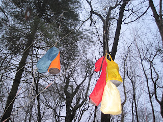
[Mouse line hanging in the Muskrat Creek Shelter, March 20, 79.3 miles from Springer.]


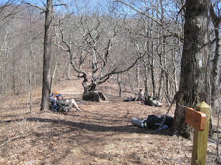
[Water break on the trail, March 22.]


[Hikers' night out [the first social outing of the southern trek so far], Cody's Roadhouse in Franklin, March 22. From left: Allgood, Lightning, Ring Leader, me, Tintin, Monkey and Prophet.]

21 hours in the Carter Gap shelter

An abbreviated retelling of the events of Sunday, March 21

11:30 a.m.

I get to the shelter, nestled in a thicket of trees and rhododendrons at 4,500 feet elevation, after a hard-charging, 3-mile hike from Beech Creek Gap. The Mist of Cold  Death has already descended ahead of schedule. The forecast calls for Thunderstorms in the afternoon. Three other hikers are there. One, Allgood, of Kentucky, has his FM radio on the table tuned to NPR in readiness for a weather report. "Wait, Wait! Don't Tell Me!" plays.

Three hikers who also camped at Beech Creek Gap, Denver, Dufus and Pebbles, show up and settle in. After an hour or so, I break my sleeping bag out and slide in to get warm. The writing's on the wall.

"I think I'm done," I say, because I don't want to summit Albert Mountain [elev. 5,250 ft.] in a T-storm. I can kind of tell that the other hikers are thinking the same thing. Nevertheless, Allgood and four other hikers head out, while the three I mentioned earlier remain and cook lunch.

Afternoon


[Interior of the Carter Gap Shelter, March 21. My sleeping bag is the orange one.]

I play with my phone, see that the weather says the T-storms aren't due until evening now. Denver and Pebbles string up a tarp along the front of the shelter. As I nap, more and more people find their way to the shelter and mill about on the other side of the tarp to get out of the cold rain. Some pitch tents, a couple claim shelter spots.

Around 5 p.m.

From force of habit, I cook food amid a collection of hikers shuffling around the elevated table in the shelter vestibule. The rain and wind whip around the shelter; I block the wind with a laminated house map. Eating temporarily breaks the lethargy of waiting for night to fall.

Night

A hiker arrives in the evening and sets up underneath the shelter, where a wood platform parallels the shelter floor, because the shelter is too full. Several other people are tenting nearby.

Around 5:30 a.m.

A phone alarm goes off in the shelter. It lasts ten minutes and wakes everyone. I get up to see if I can't squelch it; it's in the very bottom of a pack belonging to someone tenting. The alarm goes away on its own as I'm contemplating tearing everything out of the pack to get to it. I crawl back into my bag.

About 20 minutes later

It goes off again. Anger in the shelter.

"Somebody's going to find their pack in the privy," someone says.

Two hours later

I wake up and see the snow on the ground, like grits in the bowls of dead leaves. I've made a decision: I'm going to get up, get out and make it to Franklin - 16 trail miles and a hitch away - by later that afternoon. Before I leave I distribute the contents of my water bucket, which Denver fetched yesterday. The water is singeing to the skin it's so cold.

I'm the first hiker out. As I round the bend I give a final look back at Carter Gap Shelter, my chance home for 21 hours. Every step north is victory.

Saturday, March 20, 2010

Good morning, North Carolina

[The gnarled oak at Bly Gap marks the line btw Georgia and North Carolina, March 20]

I camped out here last night. After some coffee and journaling I'm off hiking, past Standing Indian Mountain.

I'm glad I went to the Wild Game dinner at McConnell Memorial Baptist Church in Hiawassee. The locals were friendly and I got to try a frog leg. Serving suggestion: Douse in lemon juice. I had two and a half cups of sweet tea to wash down dinner.

The message was definitely Baptist but not in a tent revival way: God is "standing in the road,  waiting for you to come home."

I love slow mornings on the trail. I aim to enjoy this while I can.

Thursday, March 18, 2010

Why I love zero days

I picked up my first care package of my GA->ME hike, a personal favorite since 1989: Homemade no-bake cookies!

They came with instructions to share.

Besos,  a. s.  :)

And the Hiawassee Inn attendant a few minutes ago gave me a ticket to the McConnell Memorial Baptist Church 2010 Wild Game Supper, to be held tonight, down the street.

"You ever eat bear meat?" was how that convo started. 

"No, " I answered.

"You ever eat deer meat?"

"A few days ago," I said (the venison stew at Blaze of Glory was the only time I can recall).

I'm not caught by surprise by this,  because hikers last summer told me about religion and trail maj coming intertwined in the South. I'm praying for a low-key pitch, but this being a Baptist event, I'm expecting a hectoring.

The German mother-son team I mentioned a while ago beat the odds and made it here. Good for them!

Cheers,

Ink

Photo dump, March 15-16

With the change to daylight savings time and more warm, sunny days, I'm getting in more miles and taking more photos.


[Campfire at Blue Mountain shelter, March 15. iTrod, Kate, Emily, Allgood, guy from NC whose name I didn't get, other guy. The shelter stands on a mountain at 3,900 feet elevation; lots of wind. Couple of industrious hikers found a tarp near the privy and shielded half the open face of the shelter with it.]


[Bear bags hanging from bear cables at Blue Mountain shelter. The cables take the trial and error out of hanging your food in the trees at night, which is good.]


[Eastward vista from the summit of Rocky Mountain, elev. 4,017 ft., 52 miles north of Springer, March 16. Nice day!]